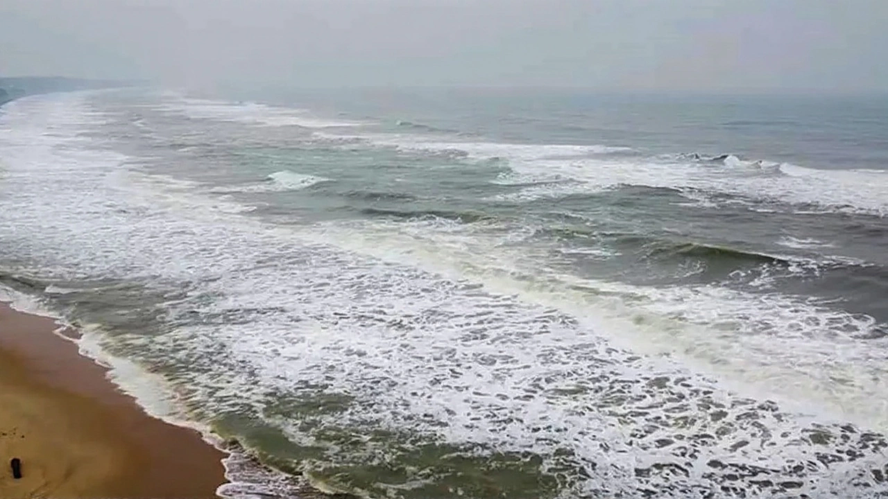
By the time the sun sets on October 28, 2025, Cyclone Montha could be tearing through the coastal villages of Andhra Pradesh, turning streets into rivers and knocking out power for hundreds of thousands. The India Meteorological Department (IMD) has confirmed the storm has intensified into a severe cyclonic storm with sustained winds of 90–100 km/h—gusts hitting 110 km/h—and is now barreling toward a landfall zone between Amalapuram and Narasapur. This isn’t just another monsoon disturbance. It’s the kind of system that reshapes lives overnight.
Why This Storm Is Different
Cyclone Montha didn’t come out of nowhere. It formed from a deep depression over the Bay of Bengal on October 24, 2025, and rapidly strengthened under ideal conditions: warm sea surface temperatures above 29°C, low wind shear, and high moisture levels. What makes it stand out isn’t just its speed of intensification—it’s the timing. October is typically a lull between the monsoon and post-monsoon systems, but this year, the Bay of Bengal has been unusually active. The IMD recorded five tropical systems since mid-September, and Montha is the most potent yet.And unlike many storms that weaken over land, Montha is expected to maintain tropical storm strength for at least six hours after touching down. That means flooding won’t be a fleeting problem. Rainfall totals could hit 250–300 mm in coastal districts, with localized downpours exceeding 400 mm. In 2023, a similar storm dumped 280 mm in 48 hours and caused over $180 million in damage. Montha could be worse.
Who’s in the Line of Fire
Andhra Pradesh is under red alert from October 27 through 29—the highest warning level. But the impact won’t stop at the coast. Odisha, already reeling from last year’s Cyclone Biparjoy, is bracing for another hit on the 28th and 29th. Telangana and Chhattisgarh are on high alert for inland flooding, while Tamil Nadu and Kerala are watching for thunderstorms and wind gusts up to 40 km/h. Even Lakshadweep and Mahe are under watch.Fishermen from Kakinada to Machilipatnam have been ordered not to go out to sea from October 25 to 29. That’s not a suggestion—it’s a mandatory evacuation of livelihoods. Nearly 80,000 fishing households rely on daily catches. A single week without work could push many into debt.
Emergency Response in Motion
The Indian Army has activated its disaster response units across three states. Helicopters are being pre-positioned near Vijayawada and Srikakulam for rapid evacuations. The National Disaster Management Authority has pre-deployed 12 rapid response teams, 300 rescue boats, and 15 mobile medical units. Schools and community halls in 47 coastal mandals have been converted into relief shelters.“We’ve seen this script before,” said Dr. R. Srinivas, a climate scientist at the Indian Institute of Tropical Meteorology. “But what’s changed is the frequency. Ten years ago, we got one major cyclone every three years. Now, it’s almost annual. And they’re stronger, faster, and more unpredictable.”
Power utilities are preparing for cascading outages. Andhra Pradesh’s electricity board has shut down non-essential grid lines in high-risk zones to prevent electrocution from downed wires. Mobile network operators are reinforcing towers and distributing portable solar chargers to emergency teams.
The Bigger Picture: Climate and Cost
Cyclone Montha’s name comes from Thailand, part of a rotating list of 169 names contributed by eight nations in the North Indian Ocean region. In Thai, it means “fragrant flower”—a poetic contrast to the destruction it may unleash. That irony isn’t lost on meteorologists. The naming system is international, but the suffering is local.Since 2018, the Bay of Bengal has seen a 40% increase in cyclones reaching severe intensity. Scientists link this to rising sea temperatures, which have climbed 0.7°C above the 30-year average. That may sound small, but in ocean terms, it’s a massive energy boost. Each degree adds roughly 7% more moisture to the atmosphere—and more moisture means heavier rain.
Insurance claims from last year’s cyclones in Andhra Pradesh totaled ₹1,800 crore ($215 million). This year, analysts expect that number to climb past ₹2,500 crore ($300 million), especially if infrastructure damage spreads inland. The real cost? The lives disrupted. The children who miss school for weeks. The farmers whose crops are washed away. The elderly who can’t reach hospitals.
What Comes Next
The next 72 hours will be critical. Forecast models show Montha weakening slightly after landfall, but its remnants could linger over central India until November 1, triggering prolonged rainfall. The IMD warns that even after the winds die down, water levels in rivers like the Godavari and Krishna may remain dangerously high.Relief efforts will shift from evacuation to recovery—cleaning up debris, restoring power, and preventing disease outbreaks. Cholera and leptospirosis are common after major floods. The Health Ministry has already stockpiled 500,000 doses of oral rehydration salts and antibiotics in Andhra Pradesh and Odisha.
Meanwhile, residents are sandbagging homes, boarding windows, and filling water tanks. In Amalapuram, a 68-year-old schoolteacher named Lakshmi told a reporter: “I’ve lived through three cyclones. This one feels different. The sky’s been quiet too long. When silence comes before the storm, you know it’s coming hard.”
Frequently Asked Questions
How severe is Cyclone Montha compared to past storms in Andhra Pradesh?
Cyclone Montha is classified as a severe cyclonic storm with wind speeds comparable to Cyclone Hudhud (2014) and Cyclone Gaja (2018), both of which caused over 100 deaths and $500 million in damage. However, Montha is forming later in the season, when coastal infrastructure is less prepared. Unlike Hudhud, which hit near Visakhapatnam, Montha’s predicted landfall near Amalapuram is in a more densely populated rural zone with weaker drainage systems.
Why is the Indian Army involved in a weather emergency?
The Indian Army is a key part of the National Disaster Response Framework. With its logistics, engineering units, and communication networks, it’s often the only force capable of reaching flooded or isolated villages within hours. In 2023, army teams rescued over 12,000 people during Cyclone Biparjoy. This year, they’re pre-positioning boats, drones, and field hospitals in anticipation of widespread displacement.
What areas outside Andhra Pradesh should be concerned?
Odisha’s coastal districts like Ganjam and Puri are on high alert for storm surge and flooding, while inland areas in Telangana and Chhattisgarh face river overflow risks. Even Tamil Nadu’s northern districts, including Nagapattinam, could see heavy thunderstorms with wind damage. The IMD has warned that rainfall may extend as far as interior Karnataka, disrupting rail and road transport for days after the storm passes.
Is there a link between Cyclone Montha and climate change?
Yes. Studies from the Indian Institute of Science show that the frequency of severe cyclones in the Bay of Bengal has increased by 60% since 2000, and their intensity has risen by 15–20%. Warmer ocean temperatures provide more energy for storms to develop rapidly. Montha’s quick intensification—from depression to severe cyclone in under 72 hours—is now more common, a trend climate scientists say will continue if global emissions aren’t curbed.
How long will recovery take after the cyclone?
Full recovery could take 6–12 months. Power and water restoration may take 1–2 weeks in urban areas, but remote villages could remain isolated for over a month. Crop damage in coastal Andhra Pradesh could affect food prices for the next quarter. The government has promised compensation, but past disbursements have taken 4–6 months. The real challenge? Rebuilding homes, schools, and fishing boats before the next monsoon season begins.
What should residents do right now?
Stay off the roads. Secure loose objects, fill containers with clean water, charge all devices, and keep emergency kits ready. If you live near the coast or in a low-lying area, evacuate to a designated shelter immediately. Don’t wait for official orders—the IMD’s red alert means danger is imminent. Listen to local radio stations, not social media rumors.